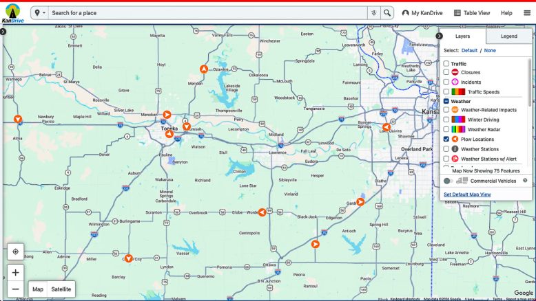

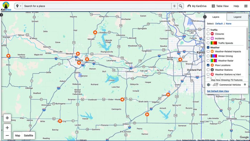
An online tool will now allow travelers to track active snowplows on Kansas highways in real time, the Kansas Department of Transportation has announced.
The tool can be found on KanDrive.gov, KDOT’s website for highway and weather conditions. The map displays snowplows as orange arrows and shows the routes they have taken during the previous two hours.
KDOT will also have 12 trucks across the state with cameras that appear on the online map as blue truck icons. People can click those icons to see recent images from the trucks.
“We’re committed to providing Kansans with timely and reliable information during winter weather events,” KDOT Secretary Calvin Reed said in a news release. “This new tool helps travelers see where crews are actively working while also providing a better understanding of the effort required to keep highways open and safe during a storm.”
Lawrence travelers can also find snow information and a map showing road conditions and where city snowplows have been at lawrenceks.gov/snow.
KDOT maintains about 9,500 miles of Kansas highways totaling more than 25,000 total lane and ramp miles.
According to the release, crews prioritize high-volume highways during storms, while working continuously to clear lower-volume routes.
The agency has about 590 dump trucks statewide and eight tow plows that clear a path up to 24 feet wide, according to the release.
If local news matters to you, please help us keep doing this work.
Don’t miss a beat — get the latest news from the Times delivered to your inbox:
Click here to learn more about our newsletters first

This post is by the Lawrence Times news team.
If you have news tips, questions, comments, concerns, compliments or corrections for our team, please reach out and let us know what’s on your mind. Email us at [email protected] (don’t forget the KS!), or find more contact info and a quick contact form at LawrenceKSTimes.com/contact.
Follow us so you won’t miss the local news that matters most to you:
Severe weather resources
Evergy outages:
• Check the status of power outages on the Evergy outage map, outagemap.evergy.com.
• Report a power outage at evergy.com/report-outage, or call 800-544-4857.
• For down powerlines, call Evergy’s emergency line, 800-383-1183, if above-ground lines are arcing or making contact with trees or vegetation. Call 911 immediately if overhead power lines are on the ground or a fire starts. Do not go near the line.
National Weather Service local office (Topeka):
• Find the latest weather forecast info and severe weather advisories for the Lawrence area at this link.
• In the event of rapidly changing severe weather, such as tornadoes, the NWS posts frequent updates on Twitter, @NWSTopeka. You do not need a Twitter account to see tweets from NWS.
• NWS is also on Facebook, facebook.com/NWSTopeka.
• Call 785-234-2592 to hear the forecast.
Douglas County Emergency Management:
• Follow @DgCoEM on Twitter or Douglas County, KS- Emergency Management on Facebook, facebook.com/dgcoem.
• Sign up to receive emergency alerts at dgcoks.org/emalerts.
• Find lots of tips on severe weather and other emergency preparedness on DgCoEM’s website at douglascountyks.org/emergency-management.
• Report storm damage (for non-emergencies only, and after storm danger has passed) by calling the nonemergency dispatch line at 785-843-0250 or 785-832-7509.
City of Lawrence snow info:
• The city has snow information and a map at lawrenceks.org/snow that shows information about road conditions and where snowplows have been. The city typically begins snow and ice control for residential roadways when 2 or more inches of snowfall or icing occurs.
Highway conditions beyond Lawrence:
• KanDrive, an app and website from the Kansas Department of Transportation, has info on highway conditions statewide. KanDrive is available online at KanDrive.gov, and its app is available for download free on the App Store and Google Play.
Air quality:
• Check the current air quality index in Lawrence and elsewhere through AirNow, airnow.gov.